Introduction to Navigation

- Duration: 2 Days (approx.)
- Location: Serpentine, WA
- Product code: NAVIGATE
Learn to read the landscape, trust your instincts and find your way with confidence.
Ever looked at a topographic map and wondered what on earth all those squiggly lines mean? Or carried a compass in your pack because you know you should have one… but secretly hoped you’d never actually need to use it?
This practical two-day navigation workshop is designed to change that.
Whether you’re keen to become a more confident and capable hiker, prepare for a multi-day adventure, explore beyond familiar trails or simply build skills that could help you make better decisions in the bush, we’ll take navigation out of the too-hard basket and make it practical, approachable and surprisingly fun.
Across two jam-packed days, you’ll learn how to use a topographic map and compass together, understand the landscape around you and develop the skills to answer three pretty important questions:
Where am I? Where do I want to go? And how do I get there?
From following trails to understanding them
Good navigation is about much more than following a little blue dot on your phone.
It’s about noticing the shape of the land. Understanding where that valley leads. Recognising a ridgeline on a map and then spotting it in front of you. Estimating how long a section should take. Knowing when something doesn’t quite feel right — and having the skills to work out why.
Over the weekend, we’ll strip navigation back to the foundations and gradually build your confidence through hands-on exercises, practical challenges and plenty of opportunities to ask questions.
And yes, there is absolutely such a thing as getting temporarily confused while learning navigation. In fact, that’s kind of the point!
Day 1 | Maps, Compasses & Making Sense of the Squiggly Lines
Our first day is all about building strong foundations.
We’ll get familiar with topographic maps and learn how to interpret the information they contain, from contour lines and grid references to scale, distance and landscape features.
You’ll learn how to:
Read and interpret a topographic map
Understand contour lines and visualise the shape of the landscape
Recognise ridges, valleys, spurs, saddles and other useful terrain features
Understand map scale and calculate distance
Use grid references to identify locations
Understand grid north, magnetic north and true north
Understand magnetic declination and why it matters
Get familiar with your compass and its different components
Take and follow a bearing
Estimate hiking time using distance, terrain and pace
Begin planning a safe and achievable route
There’ll be plenty of practical exercises throughout the day, because navigation makes a whole lot more sense when you actually do it rather than just talk about it.
By the end of Day 1, those mysterious lines, numbers and symbols should start looking less like hieroglyphics and more like a story about the landscape.
Day 2 | Take It Into the Bush
Now we put it all into practice.
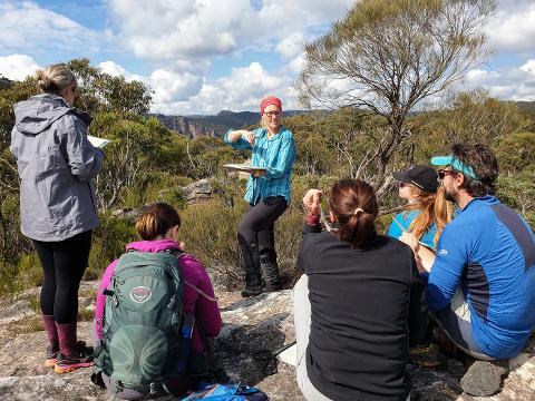
Heading into the beautiful WA bush, we’ll leave the classroom behind and start connecting what you see on the map with what you can actually see — and feel — beneath your boots!
Through a series of practical navigation exercises, you’ll practise using your map and compass together, identifying landscape features, taking bearings, estimating distance and working out exactly where you are.
You’ll learn and practise skills including:
Orientating your map to the landscape
Matching map features with real-world terrain
Taking and following compass bearings
Using features such as ridges, valleys and tracks to navigate
Estimating distance through pacing and timing
Selecting useful navigation features and checkpoints
Understanding when you may have drifted off course
Relocating yourself when you're not quite where you thought you were
Making sensible navigation decisions in the field
Planning and following a route through the landscape
We’ll work through realistic scenarios and navigation challenges designed to get you thinking rather than simply following the person in front of you.
Because the goal isn't to teach you to follow us.
It's to teach you how to find your own way.
Who is this workshop for?
This workshop is ideal for hikers and outdoor adventurers who have little or no experience using traditional map and compass navigation, as well as those who have learned the basics before but want to refresh their skills and build greater confidence.
You might be:
Getting into hiking and wanting to build your bush skills
Preparing for your first overnight or multi-day hike
Keen to tackle more remote or less-defined trails
Interested in becoming less reliant on phone-based navigation
Looking to refresh navigation skills you haven't used in years
Wanting to feel more confident making decisions in the bush
Simply curious about maps, landscapes and finding your own way
You don't need any previous navigation experience.
Bring your curiosity, your sense of adventure and a willingness to get a little geographically challenged while you learn!
More Than Just Finding North
Navigation is one of those wonderful outdoor skills that changes the way you experience the bush.
Once you begin understanding maps and reading the landscape, you start noticing things differently.
A hill becomes a contour pattern. A creek line becomes a handrail. A saddle becomes a useful checkpoint. A ridgeline becomes something you can identify both beneath your feet and on the map in your hands.
Most importantly, you become a more capable and independent adventurer.
You won't leave after two days as an expedition navigator — navigation is a skill strengthened through practice — but you will leave with a strong foundation, practical experience and a much better understanding of how to continue developing your skills.
What You'll Need
We'll provide the information you need before the workshop so you can arrive ready for both the learning and practical components.
For the field session, you'll need suitable hiking clothing and footwear, a day pack, drinking water, snacks, sun and weather protection, any personal medications and everything you'd normally carry for a day on the trails.
Most importantly, bring a willingness to learn, ask questions and have a crack.
There are no silly questions here.
How Fit Do You Need to Be?
Great question! This isn’t about smashing out kilometres or racing to the top of the next hill. In fact, good navigation is about learning to slow down, notice the landscape and give yourself time to make confident decisions.
On our practical field day, expect to walk around 5km on and off track, through natural terrain and some light to moderate scrub.
A reasonable level of walking fitness is all you need. We’ll stop regularly to learn, practise and solve navigation puzzles — because the focus is on building skills and confidence, not testing your fitness.
Build Skills. Build Confidence. Find Your Own Way.
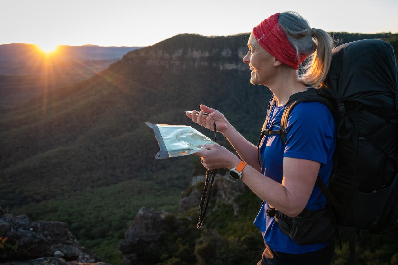
There's something incredibly empowering about standing in the bush, looking at the landscape around you, checking your map and compass and thinking:
Yep. I know where I am.
Join Caro Ryan from Lotsafreshair and Tracy Jones from OTBT for two days of learning, exploring, problem-solving and getting hands-on with one of the most valuable skills any hiker can have.
Because adventure gets a whole lot bigger when you have the confidence to find your own way.
Course Fee | $550 per person
Your Course Includes
- Two days of qualified, experienced navigation instruction with Caro Ryan of LotsaFreshAir, supported by Tracy Jones from Off The Beaten Track WA
- Full topographic map printed on water-resistant paper — yours to keep
- New Silva Ranger compass — yours to keep
- LotsaFreshAir scale ruler lanyard — a handy little tool for measuring distances and working with different map scales
- Caro Ryan's How to Navigate – 3rd Edition book (RRP $39.95)
- Map romer for accurate grid references
- Lunch on both days
- Practical exercises and real-world navigation challenges
- Plenty of opportunities to practise your new skills with experienced support close by
- A few surprise extras on the day… think of them as navigation fries with that
Most importantly, you'll leave with something you can't put in your backpack: greater confidence in your ability to understand the landscape and find your own way.
Meeting Point
Serpentine–Jarrahdale, Western Australia
Our exact training location has been carefully selected to give us a great mix of classroom learning and practical navigation opportunities in the surrounding bushland.
The meeting point and final course information will be provided to confirmed participants approximately two weeks before the workshop.
Off The Beaten Track WA is an award-winning, fully accredited Western Australian tourism business, delivering high-quality guided hiking and adventure experiences. Our trained Lead Guides and Support Guides are there to support you every step of the way, carrying two-way communication devices and a personal location beacon when mobile coverage is limited. Fully licensed and insured, we focus on creating safe, well-run and genuinely memorable experience out on the trail.


